Understand a place before disturbing it.
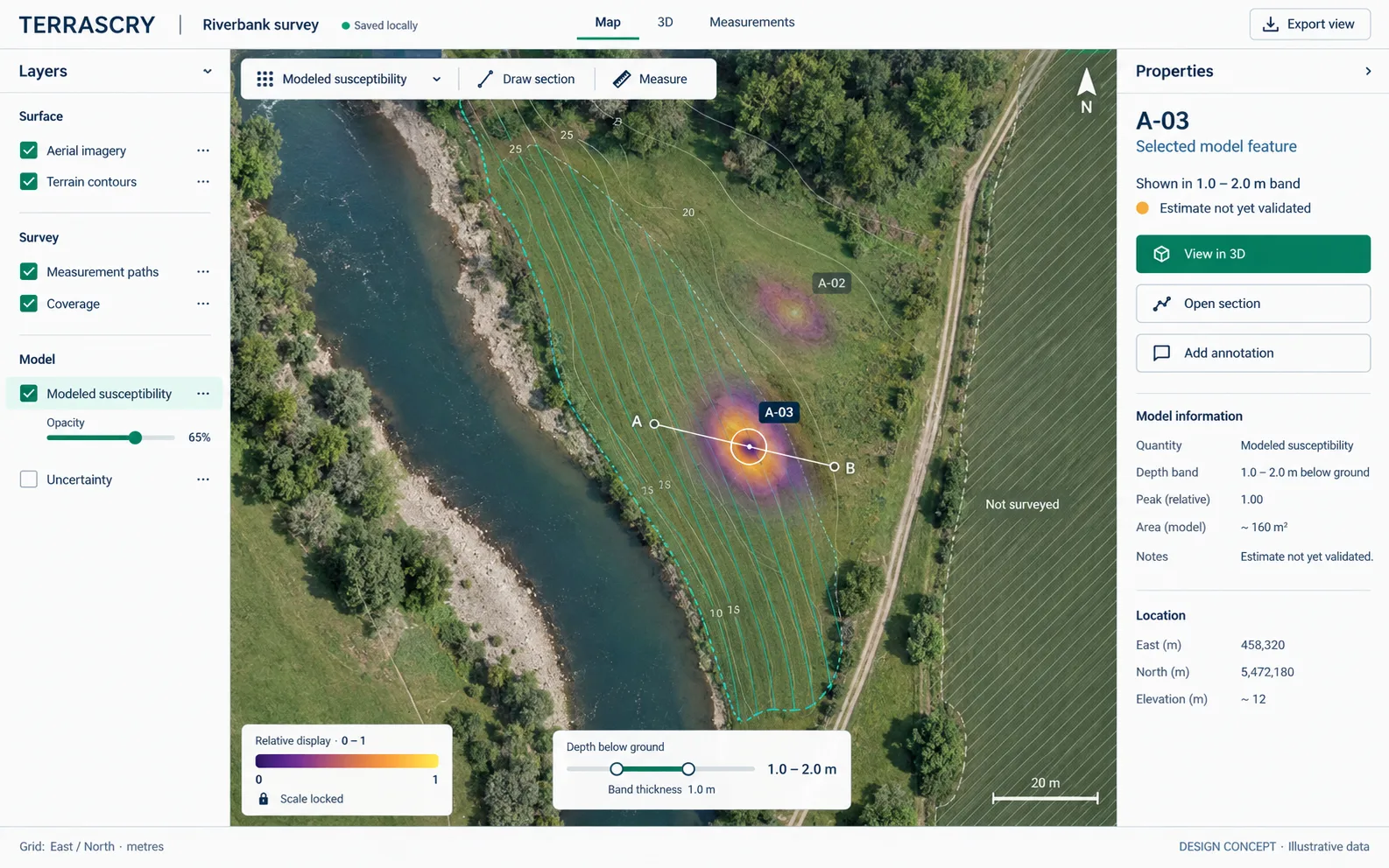
Bring survey measurements and landscape context together to investigate buried features and plan the next research question.
Geophysical software & survey instruments
Survey software. Purpose-built instruments.
TERRASCRY develops software and instruments for subsurface investigation. Review geophysical measurements in their geographic context, inspect physical models, and retain the record behind each interpretation.
Product development · Evaluation and procurement inquiries welcome
Applications
For archaeological teams, research institutions, and organizations evaluating geophysical methods for field investigation.
Bring survey measurements and landscape context together to investigate buried features and plan the next research question.
Compare signals, site context, and annotations in a shared coordinate frame. Evaluate geophysical methods within a documented investigation workflow.
Inspect recorded measurements, explore physical models, and make assumptions visible. Build understanding that others can examine and reproduce.
TERRASCRY software
A survey workspace for reviewing recorded geophysical data alongside terrain, imagery, and subsurface models. Designed for field review and detailed analysis.
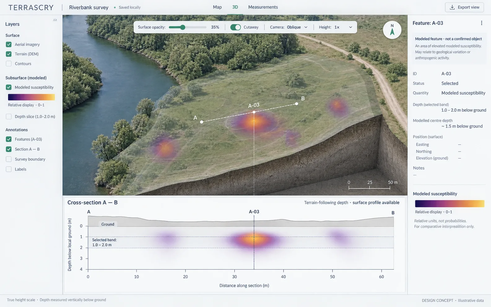
Map, 3D & cross-section
Move between the map, a 3D view, and a cross-section. Compare terrain and imagery with recorded readings and modeled results.
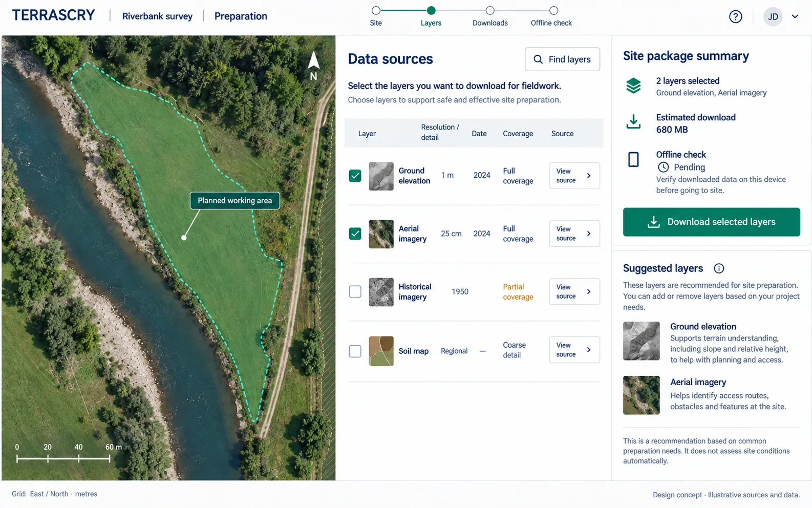
Site preparation
Combine recorded surveys with geographic context. Review source layers and coverage before interpreting the measurements.
In development: recorded magnetic survey workflows, terrain and imagery, local run records, and model inspection. Broader sensor integration and live field acquisition are ongoing work.
A connected workflow
A connected workflow for source review, model inspection, and retaining the context of an analysis.
Start with recorded measurements and geographic context. Keep track of where the data came from.
Compare readings with modeled results in map, 3D, and section views. Keep assumptions visible.
Retain run records and annotations so the next review starts with the reasoning as well as the image.
Survey instruments
Pathfinder addresses handheld survey acquisition. HIRT focuses on crosshole imaging. Both are in development alongside the TERRASCRY software platform.
Handheld magnetic and electromagnetic surveying
A handheld survey system being developed for near-surface magnetic gradient and electromagnetic conductivity measurements, with a modular sensor arrangement and georeferenced acquisition.
Intended role Portable acquisition for site-scale geophysical surveys.
Discuss Pathfinder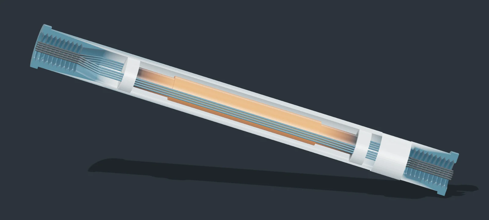

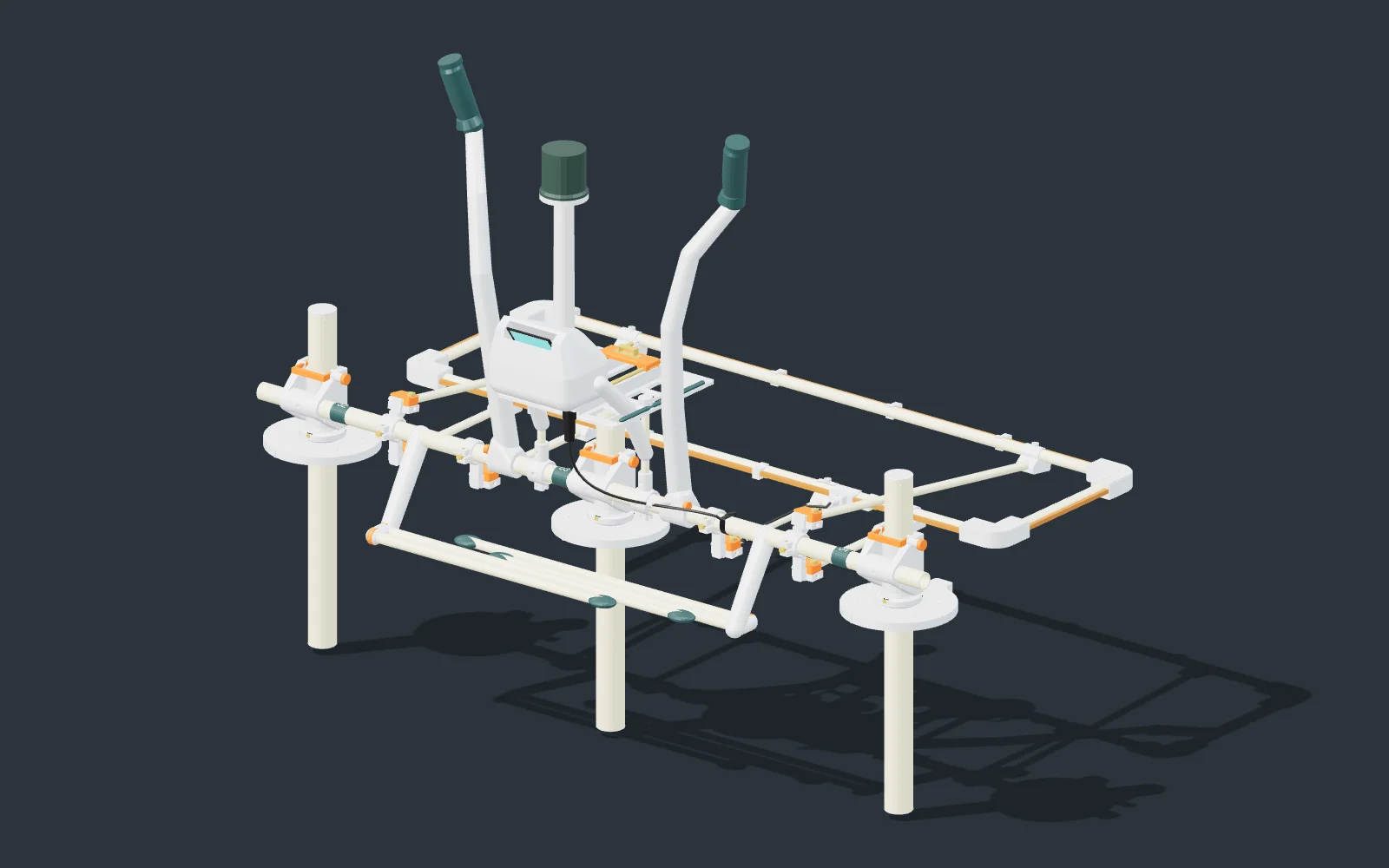
Crosshole subsurface imaging
A dual-channel crosshole tomography system being developed to collect complementary measurements between inserted probes and investigate a focused subsurface volume.
Intended role Targeted subsurface characterization using a distributed probe array.
Discuss HIRTProduct specifications, evaluation availability, and development timelines are discussed directly. CAD renders show development configurations. Bench and field qualification remain to be completed.
Government, universities & institutions
TERRASCRY welcomes discussions with government agencies, research institutions, and commercial survey organizations evaluating subsurface technologies.
Discuss the measurement requirements, data formats, operating environment, and validation evidence your team needs to assess suitability.
Request product information and discuss development schedules, evaluation options, and support requirements before planning a purchase.
Discuss field studies, reference datasets, instrument testing, and methods development.
Product & partnership inquiries
Contact us about TERRASCRY software, Pathfinder or HIRT instruments, technical evaluation, or future procurement.